MotoTerra is Full Throttle's free motocross track design app. You search your address, trace your land, and it reads your real elevation, soil, flood zone and wetlands; then you draw the track, size every jump and leave with a build sheet. Here is every step on a real track, Cahuilla Creek MX in Anza, California.
Last checked November 7, 2026: every screenshot taken that day on the live app, every number shown exactly as MotoTerra read it.
Start yours right here
Do the first steps on your own land without leaving this page: find it, trace your property and draw your loop. Then open it in MotoTerra, saved, and follow the rest of the steps below.
Sketch your track on your land
Find your land, trace it and draw the loop you want to ride. Then open it in MotoTerra, saved, to read the real ground and plan the build.
- 1. Find your land
- 2. Trace it
- 3. Draw your track
- 4. Open in MotoTerra
Loading the satellite map…
MotoTerra is our free track designer. It reads your real soil, flood zone, wetlands and elevation, sizes your jumps and prices the build.
Design a track on real land, step by step
Tap Next to move through the steps, or open all the steps as text below the picture.
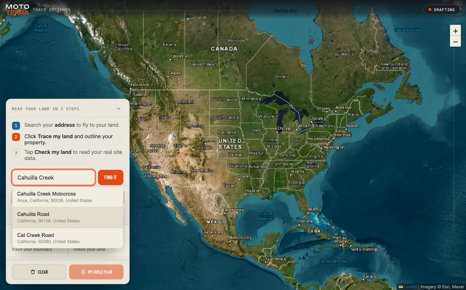
What the real read found at Cahuilla Creek
Cahuilla Creek is a working track, so it is a fair test. MotoTerra called it strong ground: 166 feet of relief across the land to build downhills and jumps into, and a rocky sandy loam it rates close to ideal for holding a jump face. It also showed what a landowner most needs to know before building: the land is in FEMA flood zone D, which federal rules define as an area of undetermined but possible flood hazards (44 CFR 64.3). That is a question for the county, not a green light.
What MotoTerra does not do for you
- It is not a survey. What you trace is your outline, not the legal property line.
- It is not a permit. Zoning, noise and land use are your county's call.
- Wetlands are read at one point. Confirm the whole parcel before you dig.
- The budget starts at typical figures. Replace them with real quotes.
For the order to plan a track in, from soil and acreage to safe jumps, read dirt bike track design: how to plan a track on your own land.
When the track is built
Designing it is the start. These are the tools Full Throttle's family of sites built for running a track:
- TrackPass sells your passes online, keeps every signed waiver and checks riders in at the gate. It is free for the track.
- The Motocross Track Association (MXTA) is a membership for track owners, with real court cases against tracks and what owners learned about waivers, insurance and minors. It also tracks inherent-risk laws state by state.
- Ayo! texts your whole list from your own phone, for when rain moves a race day.
Questions about MotoTerra
Is MotoTerra free?
Yes. MotoTerra is free and needs no sign-up. Open it, tap Start with your land and search your address.
What data does MotoTerra use?
Public maps: USGS 3DEP elevation, USDA SSURGO soil, the FEMA National Flood Hazard Layer and the USFWS National Wetlands Inventory, read for the land you trace.
What does flood zone D mean?
FEMA has not studied the flood risk there: federal rules call zone D an area of undetermined but possible flood hazards. It is not a high-risk zone and not a clear one. Ask your county before you build.
Does MotoTerra replace a survey or a permit?
No. It reads public maps and turns them into a plan. Your property line comes from a survey, and permits come from your county. Wetlands are read at one point, so confirm the whole parcel before you dig.
Can I start a design here and finish it in MotoTerra?
Yes. Sketch your land and your loop at the top of this page and tap Open my track in MotoTerra. It opens with both saved on your device, ready to read your ground and size the jumps.
Can MotoTerra design the jumps?
It sizes them. Tap a jump on your track to set the speed, takeoff angle and height, and it shows the carry and the speeds a rider lands safely at, with the dimensions on your build sheet.
On November 7, 2026 we ran MotoTerra on Cahuilla Creek MX and took every screenshot from that run, with nothing staged or edited; the numbers in the steps are the ones the app showed. Our outline of the riding area was traced by eye, and the racing line is a sample, not the track's real layout. Zone D's meaning is from the federal flood insurance rules, 44 CFR 64.3. Satellite imagery in the screenshots: Esri, Maxar.
Try it on your land
Sketch your track at the top of this page, or open MotoTerra and start there. It is free, with no sign-up.